| Haute Route Glacier Trek - Day 2 Day to day description, map and photos |
Day 2 - Cabane d'Orny to Chanrion hut
On day 2 we have almost 15 km to cover, including 830 meters of descent and over 900 meters of ascent. We begin by leaving the glacier behind and descending a trail from the Orny hut to the Grands Plans at about 2200m. From here we drop via chairlift into the charming lake-side Swiss village of Champex. A taxi picks us up here and takes us to the end of the road at Mauvoisin. Our onward trail rises gradually above the eastern slopes of the lake of the same name, to reach the Chanrion hut. Nestled among grassy meadows deep in the mountains bordering Italy, this hut is one of the more remote ones on our trek, with vistas of high peaks seldom visited by climbers. |
 |
| Sunrise at the Cabane d'Orny, and the beginning of Day 2. |
|
||||||||||||||||||||||||||||||||||||||||||

 |
| The violet line shows the Grands Plans chair lift down to Champex and the taxi ride to Mauvoisin. The red lines are the trekking sections of the route. |
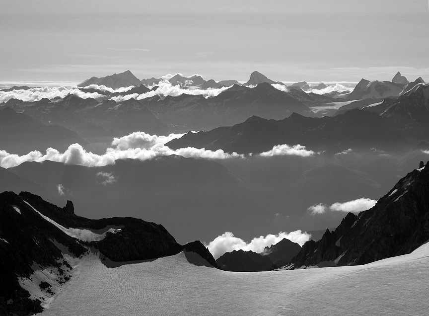 |
This photo was taken from near the summit of the Aiguille du Tour, looking east. On Day 2, we'll descend from the Orny hut (just out of view in the center of the photo), partly on trail, partly on the edge of the glacier. The three most prominent peaks on the sky line are, on the left, the Weisshorn, just right of center, the Dent Blanche, and on the far right, the spire of the Matterhorn. |
All images, layout and text © 2012 Cosley & Houston Alpine Guides, All Rights Reserved