 |
|
| Vanoise Haute Route |
| 5 days skiing Maximum
Group Size See also: |
The Parc National de la Vanoise is a wilderness area nestled between two rivers running from near Albertville, France up to the border with Italy, the Isère to the north and the Arc to the south. This part of France is home to the largest ski resorts in the world. The connected resorts of Courchevel, Meribel and Val Thorens take literally several days to explore. And not far to the north are the famous areas of Val d'Isère, La Plagne, Tignes, and Les Arcs. But removed from the hustle and bustle of commerce, is one of the largest ice caps in Europe, the Glacier de la Vanoise. This high glacial plateau extends for about 12 kilometers, and offers an unique ski touring paradise. Nearly as large as this, is the neighboring glacier plateau just to the SW, comprised of the Glacier de Chavrière and the Glacier de Gebroule. These connect with the Vanoise glacier via the wild and uninhabited valley of the Doron de Chavrière. Our tour connects these two glacial systems, from Val Thorens to the SW, to the upper reaches of the Doron de Champagny, above and NE of Courchevel. The exceptional quality of this tour lies largely in the quality of the downhill skiing. Our general direction of travel being from SW to NE, descents are mostly on north-facing slopes. The glaciers are large, the choice of itinerary is vast, so even after several days of ski touring traffic, there remain large areas of untracked snow. We would describe this tour as "medium" in difficulty. Steeper ski touring terrain is encountered here, than, say, in the Silvretta. But the downhills can all be skied quite reasonably, despite some steep sections. The Col de Labby and the Col de la Grande Casse are often climbed on foot, using boot crampons. Skiers who have enjoyed the Ortler or the Berner Oberland will also find the Vanoise within their ability. Consider extending your trip! Our starting point, the village of Brides-les-Bains, has a natural thermal hot spring which has been developed into a spa at Le Grand Spa des Alpes. This wonderful fact, coupled with the direct lift access from Brides to Meribel (and by connection to Courchevel and Val Thorens) suggests that the most reasonable plan is to "ski and spa" for at least a couple of days on either end of our tour.
|
||||||||
 |
|
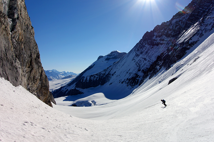
| The start of the descent from the Col de Grand Casse. | |
| Vanoise Haute Route Itinerary | |
| Day 0 | Rendezvous in Brides-les-Bains. This small town is located just to the north of the world famous ski complex of the Trois Vallées. The Trois Vallées, which include Courchevel, Meribel, and Val Thorens, is the largest connected ski area in the local universe, with over 180 lifts. These lifts can move some 260,000 skiers per hour. The vast extent of the Trois Vallées is truly mind boggling. We chose Brides as our starting point for several reasons. First, via the Olympe lift it allows easy, roadless access to the vast lift system above. Second, it is less crowded, less expensive, and more attractive than the big resort centers nearby. Last, it is easy to reach by train with connections from Geneva to Moutiers taking about 4 hours, then with a short taxi ride for the last 8 km. It is a little less than two hours by car from with Geneva or Chamonix. We'll meet in the early evening. |
| Day 1 | We begin our tour by riding the Olympe lift from Brides. This long gondola leads to the Meribel ski area. We then ride several lifts, with some piste skiing between, to arrive in Val Thorens. Normally, it takes about 2 hours to get from Brides to Val Thorens. From Val Thorens we take the lift system to the Col de Thorens at about 3100 meters. From here we finally leave the pistes, and start our climb up to the Col de Gebroulaz, at 3417 meters. A great descent awaits us on the Glacier du Gebroulaz. This is a big north-facing downhill, interesting and complex. At about 2700 meters, we turn east, pass the Refuge de Péclet Polset, and then continue north again to finally reach our hut, the Refuge du Roc de la Pêche at 1880 meters. This hut is quite nice, complete with showers!
|
| Day 2 | On day 2 we reach the Refuge de la Dent Parrachée. Our route climbs up the valley to the south, then more steeply up to the Col d'Aussois at 2914 meters. The descent from the col starts quite gently, then steepens to reach the flat floor the the valley. We ski past the Refuge du Fond d'Aussois, then climb an additional 190 meters to our hut.
|
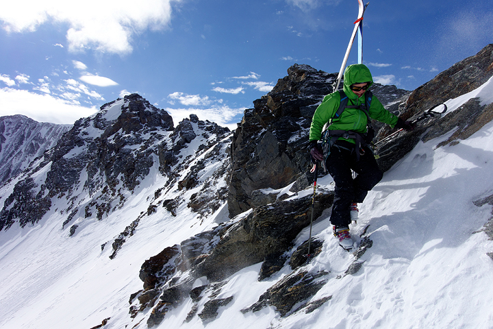
| Day 3 | From the Refuge de la Dent Parrachée we climb to the north, gaining the Glacier de Labby and finally the Col de Labby at 3324 meters. The last 100 meters are steep and if the snow is hard, best done on foot. From the Col de Labby, we have a great descent of the Glacier de la Mahure. At about 2650 meters, we traverse the slope NE to reach a shoulder at 2780 meters. A short descent to the Lac de Arpont, then another short climb leads to the final descent of about 450 meters to the Refuge de l'Arpont.
|
| Day 4 | From the Refuge de l'Arpont we have a number of options to regain the Vanoise ice cap in the vicinity of the Dôme de Chasseforêt. In any case, we start with a long skin ascent, finally reaching the summit at 3586 meters. From the Dôme, we ski gently down to the north, then more steeply to reach the Col du Pelve at 2970 meters. Climbing again, we gain the Col du Dard at 3130 meters. Our final descent to the Refuge du Col de la Vanoise starts gently, then steepens for the final 500 meters.
|
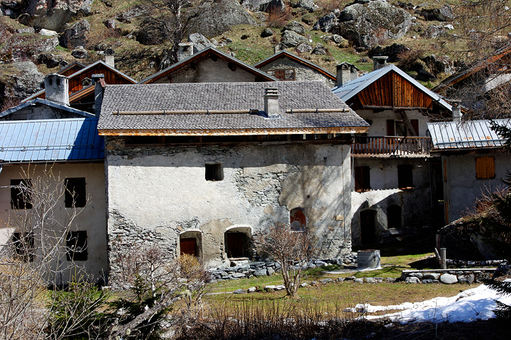
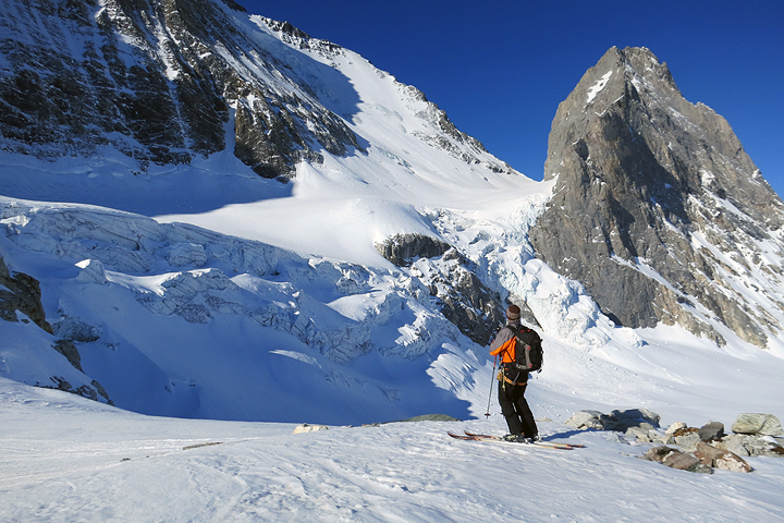
| Day 5 | Our last day is spectacular, crossing directly under the immense north face of the Grande Casse. We start with a very short descent from the hut, then steeply climb to the crest of the moraine bordering the Glacier de la Grande Casse. We'll easily climb the glacier to the final steep but short slope ending at the Col de la Grande Casse at 3091 meters. The last part of which, we'll normally do on foot. The descent that follows is superb. Traversing high under the face, we pass above a large icefall, then have long, varied, north-facing slopes to descend to about 2030 meters. From here we follow the snow-covered road all the way to Champagny-le-Haut at about 1470 meters. If the snow cover is good, we should be able to ski nearly the entire distance. From here, a short taxi ride takes us back to Brides-les-Bains.
|
 |
|
| Crossing the Col de Labby on Day 3. | |
| Skills Required |
This tour requires a high level of fitness and very good skiing abilities. On a number of days the total elevation gained is over 1000 meters (3300 feet). Being in good shape will ensure you have enough energy to manage (and have great fun as well!) on the long descents which follow. The reason that skiing skills must be at an advanced to expert level has more to do with the conservation and expenditure of energy over a long day than the absolute technical difficulty of the skiing. There are a few steep sections, but for the most part the slopes are not overly steep. The challenge comes in managing poor snow conditions (heavy wet snow, crud or breakable crust) and not losing too much energy or risking injury in the process. Great skiers look like they are hardly working, and this is in fact the case. If your skiing is not up to par you will spend far, far more energy than a better skier. Ski skills required;
Skiers who regularly enjoy black or double black runs in most western American ski areas should do fine. If you like to get off the piste and into the crud, ski the trees, and in general look for the steeper shots, you'll probably have a great time on this tour. If you tend to stick to the groomed slopes and find the wild untracked a bit intimidating you should think twice about this option. We will likely encounter all different kinds of snow, from the best to the worst, and you need to have sound, energy-efficient strategies to cope with them. A good gauge of your ability can be found in mogul skiing. If you are good in the bumps and seek them out, then you most likely have developed the rhythm and balance needed for steep or difficult snow. You must be able to ski moderate bumps in good conditions, skiing rhythmically and fluidly, following a line near the fall line with good speed control. If you have any doubt about your ability to manage the skiing on this tour, please contact us to see if we can answer your questions. Previous ski touring or mountaineering skills are useful, but not required. If you are a good skier, you will not have difficulty picking up these new skills, as you will already be comfortable on steep slopes. |
 |
|
| Le Laisonnay d'en haut, on Day 5. | |
 |
Kathy Cosley & Mark Houston AMGA Certified • SNGM members All images, layout and text ©2014 Cosley & Houston Alpine Guides, All Rights Reserved |
|
 |
|
| The Col de la Grande Casse from the east. | |
