I
am in the process of changing the way in which this page works. Eventually
with all the photos in our site, when you click on the "photo info"
at the bottom of each photo you will link to another page which contains
that photo (held in your computer's cache) and info about it. You won't
come here. But setting it up is a big job and I'm only about half way
through.
| 
|
Scroll
down through the photos to find the image you're interested in
or, click on the appropriate page or the photo in the list below
to go straight to the photos. |
| 
|
This
shot is of Jirishanca in the Cordillera Huayhuash, Peru. The Huayhuash
is a compact group of spectacular peaks not far form the Cordillera
Blanca. On our first trip there Kathy and I bivouaced beside the
trail leading up to nearby Yerupaja. We spent a beautiful night
in the open which is fortunate otherwise we might have missed
this view. Its easier to leave your camera set up on the tripod
and roll over to trip the shutter, than to get out of a tent to
do the same thing.
The
single visible star track is the product of one of the wonderful
things about Peruvian mountain sunsets. For reasons I will probably
never understand the peaks retain their alpenglow even as the
stars begin to fill the sky. Because we are close to the equator,
the sun sets quickly, permitting a long exposure (with star tracks)
along with good color on the peaks. |
Sierra
Nevada Mountaineering
|
|
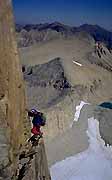
In
this image Kathy is seen guiding on the North Ridge of Mount Conness
near Tioga Pass in California. The North Ridge is a great alpine
climb, exposed, long, never too hard, varied and scenic. It can
easily be done in a day round trip from the car. This particular
pitch is a little known and very hidden variation where the climber
moves out on the north and steep side of the crest. The glacier
is straight down, a long way down, beneath your feet. |
|
|
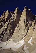
Third,
Day and Keeler Needles as seen from the trail up to Iceberg Lake
below Mount Whitney's East Face. These peaks are typical of the
High Sierra. A clean sweep of light colored granite lead up to spectacular
summits. As climbers we are fortunate that Whitney, the highest
peak in the lower 48, offers such superb and varied climbing possibilities.
Even were it not the highest, the great climbs of the East Face
and East Buttress would be popular classics. |
|
|
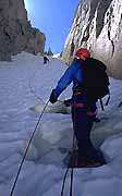
In
addition to the alpine granite, the Sierra is known for its steep
gully climbs on hard snow and ice. Here, Mike Christianson belays
Kathy on a 50° couloir on the north side of North Peak. About
6 pitches in the couloir lead to several hundred feet of steep class
4 rock climbing, ending abruptly right on the summit. These gully
climbs are best done in the Fall when the snow is bullet-proof in
hardness and the days are crisp and cool. Like Conness above, this
peak is normally done in a day from the car. It can be, and often
is, combined with an ascent of Mount Conness' North Ridge for a
great 2 day outing. |
|
|
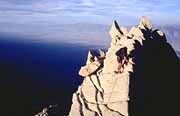
Climbing
on the North Ridge of Lone Pine Peak near Mount Whitney. Even though
this is a classic long ridge climb on great rock up to 5.7, its
unlikely you'll see anyone else on it. The route can be done in
one long day (it helps if you're familiar with it) or with a high
bivouac, carrying your gear over the summit. Lone Pine Peak rises
directly out of the Owens Valley (which can be readily seen in the
background), right on the edge of the scarp which defines the uplift
of the Sierra. This photo was taken on an AMGA guides training course
in 1996. |
|
|
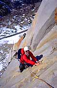
Just
outside of Bishop, California, Cardinal Pinnacle has both the ease
of access of a local rock crag and the alpine feel and definitive
summit of the surrounding high peaks. Chris Kulp is seen here on
the Regular Route, 5.6, 5 pitches in length. There are about 16
lines on this peak ranging in difficulty from 5.6 to 5.12. Most
of the routes face northwest, so on a cold day you might not want
to start too early. It's a good idea to bring a helmet if there
are other climbers above you. For the single long rappel off the
back you'll want to consider a 60 meter rope! |
Argentina
& Patagonia
|
|
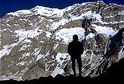
In
1992 Kathy and I climbed the Messner variation on the South Face
of Aconcagua. Though a little hard to pick out in this photo, the
route generally climbs the rounded buttress just left of Kathy's
silhouette. Taking advantage of good acclimatization from guiding
a previous ascent of the Polish Glacier Route, we were able travel
very light and fast, climbing the face with only one bivouac on
the glacier at about two thirds height. Climbing by headlamp we
reached the summit ridge at about 11 pm on our second day, spent
the rest of the night hiking down the normal route, and arrived
in the Plaza de Mulas base camp at 8 in the morning, very tired.
|
|
|
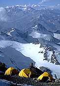
This
shot shows a high camp at about 20,000 feet on Aconcagua. This particular
camp belongs to a Mountain Travel group led by Sergio Fitzwatkins.
They ascended from the east, or Rio Vacas side of the peak, climbed
up to the base of the Polish Glacier and then traversed over to
the Ruta Normal for their summit day. This route, also known as
the Falso Polacas, is a great way to get away from the crowds on
the northwest side. Especially fun is, after summitting, to descend
the Ruta Normal to Plaza de Mulas, and hike out the Horcones Valley.
This accomplishes an almost total circumnavigation of the peak,
and also saves a day of hiking as the trek out from Mulas is only
one day. Doing a traverse requires a bit more logistics, and it
helps to use a radio from high on the peak to coordinate with the
park rangers the pick up of your base camp, which you'll have left
behind on the Vacas side. These complications are well worth it.
It is a shame to miss the scenery on either side of the mountain.
|
|

|
Sunrise
on the Fitzroy massif from the village of Chalten, Argentina. This
is an incredible place to climb. Super alpine, great rock in a beautiful
semi-wilderness setting, with, of course the horrendous weather
for which the area is justly famous. What you don't always hear,
however, is that when the weather is good, it can be extremely good.
The trick is to watch your barometer and not get caught up high
when the winds begin to blow. Climbing trips to Patagonia are a
bit of a gamble, but even on trips where we've been denied our summit,
we have always had a great time. |
|
|
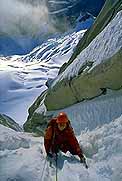
In
1990, while we were waiting for the conditions to improve on the
Cassarotto Pillar on Fitzroy (they never did, at least not enough
for us to summit) we decided to do a one day climb of Aguja Guillaumet,
one of the two impressive peaks just to the north of Fitzroy. What
a great day. A steep snow couloir, as seen in the photo, led to
the north ridge which we followed in about 8 or 10 pitches to the
top. Because of the somewhat icy conditions, the rock, up to about
5.7 in difficulty, had to be climbed in crampons. I can't recommend
this climb highly enough. It had a little of everything, and perhaps
best of all, it only took one day from our bivy at Col Superior.
Finding spells of good weather long enough to do really big objectives
can be frustrating. If your willing to dash up a few smaller peaks
like Guillaumet, you can still get in some superb climbing, even
if the good weather only comes one day at a time. |
Morocco
| 
|
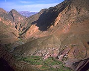
Looking
down on the village of Taghia from up on the J'bel Oujdat. Taghia
is only about a quarter mile from our base camp in the Gorge of
the same name, which is just out of site to the right. On the day
I took this photo Sue, Nancy, Kathy and I were trying to climb the
west ridge of the Oujdat. Unfortunately we encountered too much
loose rock for our tastes and rappelled after about 3 pitches. But
the view down on the village below was spectacular, as was simply
hiking the exposed goat herder tracks on the approach. After descending
we hiked around the peak via a most incredible route. |
| 
|
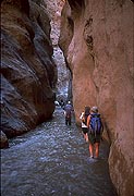
On
the last day of our trek over the Atlas Mountains we descended sown
through the M'goun gorge here. In this section of the gorge there
is no possible escape to high ground for about 3 hours walking time.
Fortunately in the fall thunderstorms, and consequent flash floods
are quite rare. We left our camp that day early, and were through
the narrowest part of the gorge before afternoon cloud buildup.
The
M'goun gorge is a major transport route to the wide and fertile
upper valley. We passed many locals riding mules both up and down.
I'm always so impressed to see such a developed economy so far from
roads and motorized vehicles. Given the depth of the gorge, it will
likely be a long time before cars make it into the upper reaches
of the valley. |
| 
|
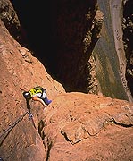
In
this photo Nancy Savickas, stems up toward the 5.10b crux of the
Chibania Route on the Aiguille du Couchant in the Todra Gorge. This
long route climbs a very steep wall on superb limestone. The route
was recently equipped with good bolts, though as always on a long
route like this its a good idea to bring a small rack. I know we
were glad we did. The Todra gorge is a wonderful place to rock climb.
There are 2 nice hotels in the gorge just out of view to the right.
Long routes, short routes, easy and hard, there is something for
everyone.
Down
in the river below a large crowd of tourists strolls downstream.
The Todra Gorge is so famous for its impressive walls and huge spring
(the river emerges in full force right out of the gravel near the
hotels) that we often saw tour buses. Climbers most definitely are
a celebrated minority there. |
Newsletter
Winter 1997-8
|
|
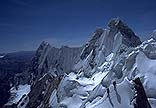
This
photo was taken on an exploratory climbing day with Mark and Jean-Claude
Latombe while scouting out a possible route on the left edge of
the Yerupaja's West Face in the Cordillera Huayhuash, Peru. We named
this point "Promontoire Internationale" in honor of French, American
and Peruvian elements. Though not much of a summit in its own right,
it is a splendid vantage point from which to view Jirishanca and
Rondoy, visible behind. Unfortunately we were unable to find a feasible
route up the West Face. |
|

|
Chris
Kulp is just finishing pitch 9 of 11 on the North Face of the Gran
Paradiso, Italy. This great ice climb tilts up at about 50 degrees
for its entire length. The face is wide and it is possible to climb
most anywhere you want, all being about the same steepness. Its
a great climb, objectively safe (as north faces go) smooth and uncrowded.
Unusual for many routes in the Alps, we had this one all to ourselves
on a perfect August day. The climb finishes with enjoyable mixed
climbing on the ridge to the rocky summit, then an easy descent
down the normal route back to the hut, wild ibex and a cold beer.
|
|
|
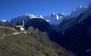
Soglio,
Switzerland, is perched high on a warm and sunny alpine bench directly
across from the famous peaks of Bregaglia. These peaks are very
reminiscent of the Bugaboos of Canada, clean granite towers rising
directly from crevassed glaciers. The famous Piz Badile is one of
these towers and is just out of view on the right. Great routes
on the Badile include the Cassin Route on the NE Face and the incomparable
North Ridge, described in some guide books as the best ridge climb
in Europe. You have to climb it to believe it - about 3000 feet
of clean granite, never harder than 5.7. |
|

|
In
this photo Robert Conway of New York stands on a rocky promontory
near the foot of the Riffelhorn, Switzerland, with Monte Rosa behind.
As with many peaks in Europe, the views from the Riffelhorn are
impressive. The Matterhorn is just behind us and the long alpine
north wall of Liskamm, Castor, Pollux and the Breithorn all stretch
out to the right of Monte Rosa. The Riffelhorn is a great little
training climb, not hard or long, but thoroughly enjoyable on good
rock. |
Newsletter
April 1998
| 
|
This
shot, from the summit of the Matterhorn, is a black and white
version of our home page cover photo. Though compressed and a
bit foreshortened, the peaks in the background form a giant alpine
wall dividing Switzerland on the left from Italy on the right.
Closest to us are the Breithorn, then Castor and Pollux, Liskamm
and finally the many summits of Monte Rosa. All of these peaks
are well over 4000 meters tall, with the highest, the Dufourspitze
being the tallest peak in Switzerland at 4634 meters. |
| 
|
This
shot is taken in cave behind the crux pillar on Louise Falls,
just above Lake Louise in Banff National Park, Canada. The pillar
sports about 60 feet of near vertical ice. Sometimes the best
line climbs straight up the outside face while at other times
you can come into this cave and climb around onto the face just
to the left of the climber. In any case it is worth looking for
a groove in which you can stem, taking weight off the arms. Either
way, it can be an intimidating pitch though the ice is generally
very good and takes protection well (assuming you have the strength
to place it!) From the climbers position it is probably possible
to see the famous Chateau lake Louise at the far end of the lake.
This is only one of the many incredible waterfall routes in the
Canadian Rockies. |
Newsletter
December 1998
| 
|
Here,
Kathy and friends are making their way up to the great slopes
below Bear Creek Spire in the Sierra Nevada. The basin above them
holds snow to very late in the year, with a small pocket glacier
and hard ice visible in the fall season. Bear Creek Spire lies
at the head of the Rock Creek valley. This is a great place to
tour with normally very easy access and a wealth of skiing and
hiking terrain. There are a number of very fine routes on the
Spire, including the North Arête (climbing the clean rock
just ahead of the second skier), the Northeast Ridge (just behind
the first skier) and the East Arête, forming the left skyline.
|
|
|
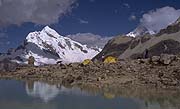
Chopicalqui,
at 20,812 feet, is seen behind from the normal high camp on Pisco
Oeste, itself an 18,867 foot summit. The normal route on Chopicalqui
lies on the right hand skyline, after traversing across the glacier
below the west face, seen here. It is a classic snow and ice route,
with a few belayed steeper sections in a fabulous position. The
ring of peaks surrounding the Llanganuco Valley (the approach for
both Chopicalqui and Pisco) include Huascarán, Chacraraju,
and the multiple summits of Huandoy - some of the most spectacular
mountain scenery in the world. |
| 
|
Kathy
is just arriving at high camp at about 19,000 feet on Khan Tengri
in the Tien Shan mountains of Kyrgyzstan. The views from this camp
are incredible. To the south is the highest backbone of the Tien
Shan, a long string of peaks over 20,000 feet in elevation, including
the highest in the area, Pik Pobeda at 24,400 feet. Khan Tengri
is perhaps the most spectacular with a rock, classic pyramidal shape.
We never did get enough stable weather to make a serious attempt
on the summit. One this trip, Jean-Claude Latombe, Kathy and I waited
for several days, hoping it would stop snowing. The day this photo
was taken was by far the best we had. Descent in whiteout and avalanche
hazard was interesting, to say the least. Maybe next time.......
|
|
|
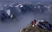
Two
climbers are just arriving at the summit of the Jungfrau in the
Bernese Oberland, Switzerland. On this particular day the fog followed
us to only a couple hundred feet from the top, and we never know
if we were going to break clear. The Jungfrau is a classic mixed
route. It begins in the predawn hors crossing the glacier, to a
lower rock buttress which is climbed on 3rd and 4th class rock to
more snow. The final tower of the peak is mixed snow and rock, typically
belayed but never extreme. |
|

|
This
photo is fairly old. Back in the winter of '84 Kathy and I did the
Haute Route. We skied it on our old skinny 3-pin gear in the mid
winter month of February. None of the huts had guardians, but they
all have winter rooms open should some poor lost soul need shelter.
We had to carry all our food and cooking supplies (hence the rather
large pack Kathy is sporting), and every evening we snuggled under
blankets piled high to keep us warm in the freezing cold huts. |
|

|
The
Dolomites with a light dusting of November snow. The Dolomites are
a large and complex sub range of the Alps. There are many different
and distinct sections separated by passes and deep valleys. One
completely unique aspect of the Dolomites are the large number of
via ferrata. These are "climbing routes" equipped with ladders,
cables and other hardware to permit passage by non belayed climbing
in areas which would otherwise be completely beyond the reach of
a normally skilled scrambler. |
| 
|
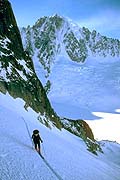
This
photo shows Kathy skiing up toward the Col du Chardonnet above the
Argentière Glacier, Mont Blanc Massif, on the second day
of the classic Chamonix to Zermatt Haute Route. Having left the
Argentière hut, below and to the left, we will cross the
Col above us, cross another high pass, the Fenêtre de Saleina,
and continue to the Trient hut for the night. The Col du Chardonnet
is fairly steep on the east side and normally requires the use of
the rope. The skier can either rappel with skis on or down climb
the short steep slope, cross the bergschrund below to gain the glacier.
The Aiguille Verte is behind. |
Newsletter
November 1999
| 
|
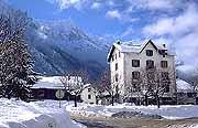
In
February of 1999, the entire chain of the Alps received record
snowfall, and with it, extreme avalanche hazard. Not long after
this photo was taken, the valley received another meter of snow
in about a 40 hour period. This brought down numerous huge avalanches,
one of which destroyed some 11 chalets near the town of Le Tour,
killing about a dozen people. This photo, taken in Les Praz, just
a few Kilometers up valley from Chamonix, shows an unusual amount
of snow on the valley floor. Behind is the Aiguille du Midi. We
have to admit beautiful sunny days like this, just after a good
storm, are an irresistible temptation to hit the slopes. |
|
|
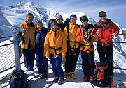
A
photo by Alan Kearney, this shot is of the group that joined us
on the Haute Route of April 1999. Left to right are Mark, Kathy,
"Mo" Moceri, Anne Danieli, Nancy Knoble, Ramsay Thomas and Jay Foster.
On this day we are skiing the Vallée Blanche. The day before
it snowed a meter of new but this day was absolutely perfect. Because
of the unusual amount of new snow we decided to skip the first part
of the Haute Route which includes some steep and avalanche-prone
slopes and begin our tour in Verbier. The photo here is shot form
the terrace of the Aiguille du Midi upper téléphérique
station. Mont Blanc and Mount Maudit are in the background. |
| 
|
This
photo shows part of the ridge very near the summit of the Zinalrothorn,
near Zermatt, Switzerland. On the day that this shop was taken,
Chris and I left the hut in the rain. The forecast called for improving
weather but hiking up the glacier in the predawn drizzle was not
encouraging. The higher we got, however, the better the weather
became. We climbed the technical rock sections in crampons because
of the slippery new snow on the route. The old motto "put yourself
in a position to be lucky" seemed to work for us that day. The Zinalrothorn
is a great climb, much better rock and higher quality that the nearby
Matterhorn. |
| 
|
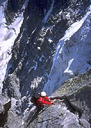
Chris
Kulp works his way up a crack high on the Frendo Spur of the Aiguille
du Midi. The Frendo has a bit of a fearsome reputation. It's quite
long and involves a wide range of climbing skills, lots of rock,
but also a good helping of ice and snow. After many hours on the
lower rock buttress we encountered the snow arête. Moving
together as high as we could we still ended up pitching 6 long rope
lengths of 45 to 60 degree ice to reach the easy crest of the ridge.
It is a super classic hard route nonetheless, requiring all around
good mountaineering skill - never extreme, but always serious.
Be
sure the forecast is good and the rock on the upper part is relatively
dry. On the day we climbed, in August of 1999, there was still a
bit of new snow on the rock high on the route (only in protected
pockets). It had been several days since the snow fell and all the
steep rock had cleared. |
| 
|
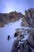
This
shows the entrance couloir to the Contamine route on the North Face
Triangle of the Mont Blanc du Tacul. The climb starts with about
5 or 6 pitches in the couloir (this looks to be about pitch 2 or
3), before gaining the mixed climbing on the ridge crest above.
A wonderful route, it is never very hard, but offers great moderate
mixed climbing with a lot of exposure. On routes such as these,
climbers need to be more efficient than anything else. The important
thing is to keep moving, to keep the flow of the climb going. After
a couple hours and many pitches of mixed ground, the route gains
the occasionally corniced snowy ridge with leads to the summit of
the Tacul at almost 14,000 feet. By catching an early téléphérique
from Chamonix, this route is perfectly feasible in a day round trip
from the valley. The contrast of high alpine routes with comfortable
hotels and good dining is what makes climbing in the Alps so memorable.
|
| 
|
Wall
detail on a building in Zaouia-Ahanesal in Morocco. Z-A, as we came
to call it, is the start of our trek into the Taghia gorge area.
A 7 hour drive from Marrakech Z-A is only about 3 hours of beautiful
waking from Taghia. One of the things that impressed us most about
Morocco was the organic look to the towns and villages. With most
building made out of local stone and mud, they appear as if they
grew out of the earth, mimicking color and texture. Surrounding
buildings such as this were others in various states of decay, dying,
returning to the earth. In the river beds endless groves of very
green date palms contrasted wildly with the browns of the building.
This was especially so near Tinerhir and the Todra Gorge where the
river valley looks like a giant green snake with its head in brown
limestone cliffs and its tail flowing out to the dry desert. |
| 
|
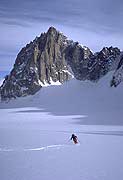
Kathy
is skiing down the Cirque Maudit with the Tour Ronde in the background.
While the popular Vallée Blanche descent is only out of view
and down to the left, if you are willing to slap on a pair of skins
and tour up into one of the many unvisited cirques you'll be rewarded
with untracked snow and lots of solitude. There are lots of places
in the Alps with great skiing and climbing, and few other people.
All you have to do is expend slightly more energy than the next
guy. In the case of this tour, what set us apart was the fact that,
unlike the downhill skier of the Vallée Blanche, we had touring
gear and could skin uphill. Less than an hour of skinning up the
gentle glacier brought us to this lonely place. We did the same
thing on another day skinning up the Leschaux Glacier high under
the north face of the Grandes Jorasses, laying tracks down perfect
virgin powder. |
All images,
layout and text ©1999 Cosley & Houston Alpine Guides, All Rights
Reserved
|