 |
|
| Chamonix
to Zermatt Haute Route Glacier Trek |
| Difficulty Dates Maximum
Ratio Day
to day detail, See also: |
Chamonix, Zermatt—the names of these celebrated alpine towns are familiar world-wide. Both lie in the shadows of world-famous peaks, both supported the heroics of the earliest alpinists, and both still draw millions of tourists, trekkers and climbers today. The high glaciated route connecting the two is equally well-known. Since the late 1800's it has drawn walkers from around the world. This demanding, varied route wanders deep among high mountain glaciers and passes, as well as passing through traditional alpine villages and towns providing a huge variety of terrain and scenery. What exactly is the Chamonix to Zermatt Haute Route? Actually there are three distinct Haute Routes commonly done, and we offer programs for all three:
The route described here is the latter. Though there are many variations possible, it follows more or less the route of the original High Level Route. Our itinerary has us overnighting in catered high mountain huts. This is not by any means a mere hiking trip; nearly every day involves moving over difficult and rugged ground, often off trail or on only the slightest of tracks, dealing with steep slopes, unstable rock, snow and ice including crevassed glaciers. But the difficulty of this route is well compensated by stunning views, indelible memories, and the satisfying sense of achievement that follows any great effort. Booking your trip We offer this trip as either an open trip, on which you can sign up by yourself and join a group, or, as a private program for just you and your friends/family. For booking either an "open" trip or a private trip, you can fide more information on the booking procedure here, Booking Trekking Information. Guiding fees are the same for either an open trip or a private trip. Fee information for the Chamonix to Zermatt Haute Route Glacier Trek can be found here. Group size and composition Kathy will be leading our trip for 2018. Maximum group size is 5 trekkers with Kathy.
|
|||||||||||||||||||
| Nature of hazards
and difficulty |
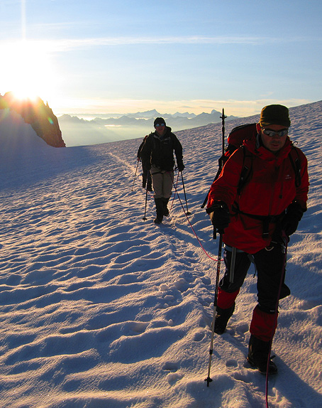
The Haute Route Glacier Trek is a high mountain route with all that that implies. The route we follow involves travel on glaciers most days, and most of the remaining travel is not on marked or maintained trails. We cover from 10 to 16 kilometers most days and our elevation gains or losses per day are occasionally in excess of 1000 meters. However, the length and difficulty of every day can't be accurately expressed based solely on these statistics. The challenge that they represent is not comparable with the same distance and vertical gain or loss on well-trodden trails. Moving over boulders, ice, soft snow, or scree, especially when the terrain is steep or unstable, can be much more taxing and require care, agility and balance beyond that demanded by hiking on rough trails. There are many variations to the summer Haute Route. The one we have chosen is perhaps the most difficult normally practicable option. We stay high, crossing several high passes that some variations avoid, such as the Cols de Lire Rose and du Mont Rouge on day 3, and the Pigne d'Arolla on Day 4, among other challenging passages. Though more difficult, we feel that these classic high alpine cols and summits offer the most rewarding experience and are worth the additional effort and skill that they require. Due to their difficulty, we sometimes have to change our itinerary to avoid these areas if the weather and conditions are not favorable. Even though we offer this trip in July, when the weather is typically dry and relatively warm, new snow is possible, especially at higher elevations, and this can make travel considerably more difficult. The most significant hazard is that of falling on exposed terrain above hazards or dropoffs. The track is often unstable and sometimes requires us to negotiate steep or loose terrain above cliffs or long steep slopes where a fall could have very serious consquences. Most of these passages are not particularly difficult technically, and it is not practical or possible to protect all of these passages by means of ropes. Therefore, and because of the serious consequences of a mistake, participants must have the skill to safely negotiate delicate terrain relying only on their own balance and competence to avoid a fall. Additionally, snow-covered glaciers have hidden crevasses. It should be noted that although these present a concern even when roped up, crevasse falls are very rare. Rockfall is also a possibility any time we are on steep ground, but for most of the route this hazard is not common. Hypothermia is another risk we need to manage. With proper clothes, however, and being sure to keep warm without sweating, should avoid this problem. Much more common, but not so life-threatening, are blisters and sunburn. If you are not put off by the thought of the hazards and challenges presented here, then this trip is for you. However if rough ground and high mountain conditions and terrain are not your cup of tea, then you should probably consider the "Walker's Haute Route" which stays almost exclusively on trails. |
Prerequisite Skills |
This trek takes us over both untracked glaciated terrain and climbers' tracks which are not maintained or marked, where the footing can be unstable, and where loss of balance or imprecise footing in the wrong place can result in a very serious fall. For this reason, and because of the distances travelled and elevation climbed per day, trekkers should have the following abilities: Fitness: Fitness is the most important attribute to a successful trip. We offer three ways to measure your fitness level. Your best assessment will involve doing all three.
Agility and "sturdiness": This quality is much harder to measure and to attain with a modern lifestyle! But basically one must have good enough balance and agility to hike through boulders, loose scree and snow, and still maintain a steady pace, even if somewhat slower than one's on-trail pace. Previous mountaineering experience: While this is helpful, mostly because it can indicate a good level of the above skills, it is not required. Roped travel on glaciers, use of crampons and ice axe, these are relatively quick skills to pick up, and between our introduction early in the trip, and daily reinforcement, we should be able to attain the skills fairly quickly, if the previous two qualities of fitness and agility are there. If you have any questions regarding your fitness and preparation for this trek, please contact Kathy to discuss your background and details of the trip. Remember, the most important qualification is an excellent level of fitness and stamina. Good agility, a head for heights, and a sense of adventure are also key ingredients to enjoying this strenuous itinerary! If you have any questions about the appropriateness of this trip for you, please contact us. As a point of interest, there is a very good discussion of necessary fitness for climbing Mont Blanc on John Taylor's Mont Blanc Guides fitness page. Though Mont Blanc is harder than the Haute Route, it is not a great deal harder. Your fitness for the Haute Route should be nearly as high as that required for Mont Blanc. |
 |
|
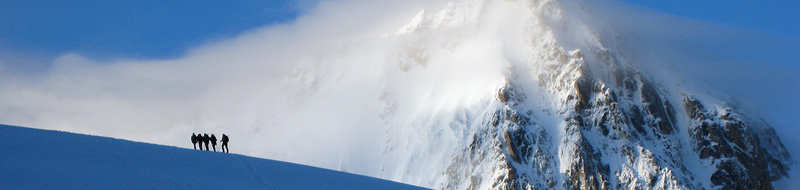
| Trekkers on the Trient Glacier, almost to the Col Supérieur du Tour. Day 1. | |
| Chamonix
to Zermatt |
|
| Day 1 |
Chamonix to Cabane d'Orny. |
| Day 2 |
Cabane d'Orny to Chanrion hut. |
| Day 3 |
Chanrion hut to Dix hut. |
| Day 4 |
Dix hut to Vignettes hut. |
| Day 5 |
Vignettes hut to Bertol hut. |
| Day 6 |
Bertol hut to Schönbiel hut. |
| Day 7 |
Schönbiel hut to Zermatt. |
 |
|
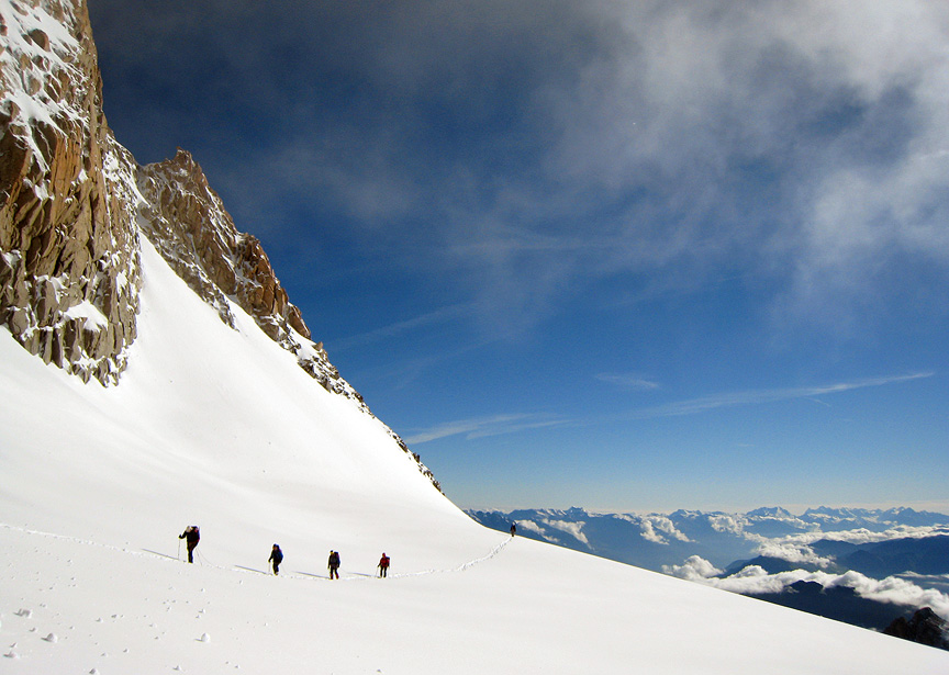
| Almost to the Schönbiel hut under the North Face of the Matterhorn, day 6. | |
 |
|
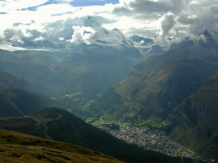
| Zermatt, at the foot of the Matterhorn. | |
 |
Kathy Cosley & Mark Houston AMGA Certified • SNGM members All images, layout and text ©2009 Cosley & Houston Alpine Guides, All Rights Reserved |
|

 |
|
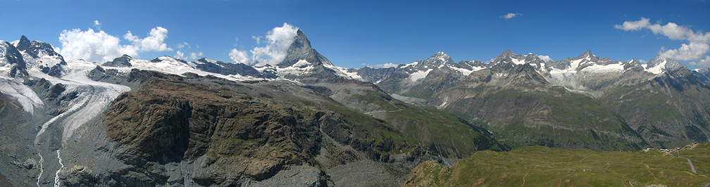
| The peaks on the west and south sides of the Mattertal. | |